Geolocate

Ickleford topographic map

Click on the map to display elevation.

About this map

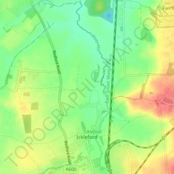
Name: Ickleford topographic map, elevation, terrain.

Location: Ickleford, Hitchin, North Hertfordshire, Hertfordshire, England, United Kingdom (51.96263 -0.30008 52.00218 -0.25253)

Average elevation: 58 m

Minimum elevation: 33 m

Maximum elevation: 92 m

Other topographic maps

Click on a map to view its topography, its elevation and its terrain.

Gear up for your next adventure:

🎒Backpack Rain Cover - External shield to keep your entire pack dry
👟Trail Running Shoes - Agile footwear for fast-paced topographic exploration
🔭Compact Monocular - One-handed bird watching and trail spotting
🔋Emergency Crank Radio - Weather alerts and power without needing batteries
🥤Collapsible Travel Cup - Saves space and weight in your mess kit

As an Amazon Associate, this site earns from qualifying purchases at no extra cost to you.