Geolocate

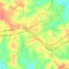
Cheohee topographic map

Click on the map to display elevation.

About this map

Name: Cheohee topographic map, elevation, terrain.

Location: Cheohee, Oconee County, South Carolina, 29686, United States (34.88231 -83.06765 34.92231 -83.02765)

Average elevation: 339 m

Minimum elevation: 308 m

Maximum elevation: 386 m

Other topographic maps

Click on a map to view its topography, its elevation and its terrain.

Seneca

United States > South Carolina > Oconee County

Average elevation: 265 m

Walhalla

United States > South Carolina > Oconee County

Average elevation: 296 m

Salem

United States > South Carolina > Oconee County

Average elevation: 316 m

Seneca

United States > South Carolina > Oconee County

Average elevation: 265 m

Salem

United States > South Carolina > Oconee County

Average elevation: 316 m

Seneca

United States > South Carolina > Oconee County

Average elevation: 265 m

Gear up for your next adventure:

🥾Trail Hiking Boots - Supportive boots for rough trails
🥾Hiking Gaiters - Protect legs and shoes from mud, snow, and debris
🥾Mountain Hiking Boots - High-traction boots for rocky terrain
💡Solar Camping Lamp - Eco-friendly lighting for campsites
🧴Insect Repellent - Protect yourself from bugs during outdoor adventures

As an Amazon Associate, this site earns from qualifying purchases at no extra cost to you.