Geolocate

Catlett topographic map

Click on the map to display elevation.

About this map

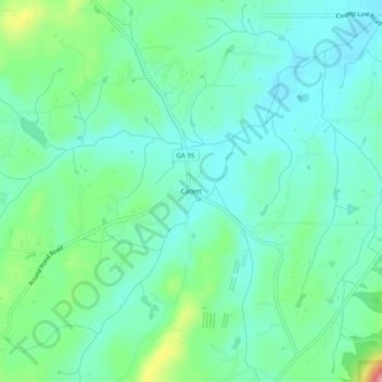
Name: Catlett topographic map, elevation, terrain.

Location: Catlett, Walker County, Georgia, 80739, United States (34.72952 -85.21245 34.76952 -85.17245)

Average elevation: 287 m

Minimum elevation: 252 m

Maximum elevation: 392 m

Other topographic maps

Click on a map to view its topography, its elevation and its terrain.

Chickamauga

United States > Georgia > Walker County

Average elevation: 238 m

LaFayette

United States > Georgia > Walker County

Average elevation: 276 m

Rossville

United States > Georgia > Walker County

Average elevation: 251 m

Chickamauga

United States > Georgia > Walker County

Average elevation: 238 m

LaFayette

United States > Georgia > Walker County

Average elevation: 276 m

Gear up for your next adventure:

🔪Outdoor Multitool - Versatile tool for repairs and food prep in the wild
🥾Approach Boots - Comfortable boots for hiking and climbing approaches
🧴Waterproofing Spray - Restore the DWR coating on jackets and tents
🪑Ultralight Camping Stool - Compact seating for rest stops during long hikes
🧤Rechargeable Heated Gloves - Extreme warmth for Canadian winter expeditions

As an Amazon Associate, this site earns from qualifying purchases at no extra cost to you.