
Thank you for supporting this site ❤️
Make a donation
Make a donation
Gear up for your next adventure:
As an Amazon Associate, this site earns from qualifying purchases at no extra cost to you.
Harlösa topographic map
Click on the map to display elevation.
Thank you for supporting this site ❤️
Make a donation
Make a donation
Gear up for your next adventure:
As an Amazon Associate, this site earns from qualifying purchases at no extra cost to you.
About this map
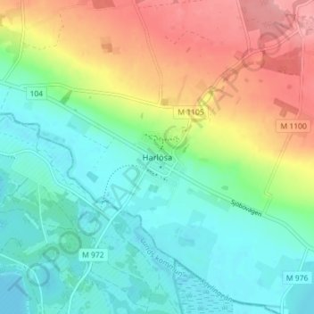
Name: Harlösa topographic map, elevation, terrain.
Location: Harlösa, Eslövs kommun, Skåne County, 24165, Sweden (55.69761 13.50561 55.73761 13.54561)
Average elevation: 54 m
Minimum elevation: 16 m
Maximum elevation: 123 m
Thank you for supporting this site ❤️
Make a donation
Make a donation
Gear up for your next adventure:
As an Amazon Associate, this site earns from qualifying purchases at no extra cost to you.