Geolocate

Egerton topographic map

Click on the map to display elevation.

About this map

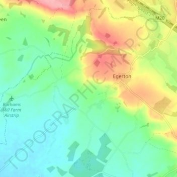
Name: Egerton topographic map, elevation, terrain.

Location: Egerton, Ashford, Kent, England, United Kingdom (51.17262 0.68183 51.21149 0.74944)

Average elevation: 63 m

Minimum elevation: 26 m

Maximum elevation: 129 m

Other topographic maps

Click on a map to view its topography, its elevation and its terrain.

Stonebridge Green

United Kingdom > England > Kent > Ashford > Egerton

Average elevation: 80 m

Gear up for your next adventure:

🦟Insect Repellent - Keep mosquitoes and black flies away in wooded areas
🥾Lightweight Hiking Boots - Boots for comfort and mobility on long hikes
🔪Outdoor Multitool - Versatile tool for repairs and food prep in the wild
🔥Emergency Fire Starter - Reliable ignition source for all weather conditions
🔦UV Flashlight - Detect minerals or specific insects in the dark

As an Amazon Associate, this site earns from qualifying purchases at no extra cost to you.