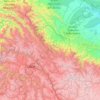
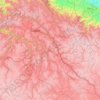
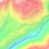
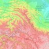
Vilcabamba topographic map
Click on the map to display elevation.
Vilcabamba
Vilcabamba District is one of fourteen districts of the La Convención Province in the Cusco Region in Peru. The capital of the province is the Centro Poblado Lucma, which has an elevation of 2,943 metres (9,656 ft). Vitcos was an important city of the Neo-Inca State (1537-1572). Its ruins are now preserved as Rosaspata and Nusta Hisp'ana (the "White Rock").
About this map

Name: Vilcabamba topographic map, elevation, terrain.
Location: Vilcabamba, Province of La Convención, Cusco, Peru (-13.42646 -73.45515 -12.65889 -72.64645)
Average elevation: 2,770 m
Minimum elevation: 699 m
Maximum elevation: 5,851 m
Other topographic maps
Click on a map to view its topography, its elevation and its terrain.