South District topographic map
Click on the map to display elevation.
About this map
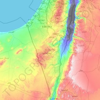
Name: South District topographic map, elevation, terrain.
Location: South District, Israel (29.48779 34.26750 31.87282 35.47601)
Average elevation: 480 m
Minimum elevation: -415 m
Maximum elevation: 1,715 m
Other topographic maps
Click on a map to view its topography, its elevation and its terrain.
Arad
The plan took into account topography and climate, with residential buildings constructed with large inner courtyards that offered protection from the desert sun and wind. High density residential areas were built first in order to create an urban milieu and shorten walking distances.
Average elevation: 579 m
Golan Heights
Israel > North District > Golan Regional Council
The plateau that Israel controls is part of a larger area of volcanic basalt fields stretching north and east that were created in the series of volcanic eruptions that began recently in geological terms, almost 4 million years ago. The rock forming the mountainous area in the northern Golan Heights,…
Average elevation: 533 m
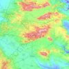
Nazareth
Israel > North District > Nazareth
As of the early 1990s, no city plans drafted by Nazareth Municipality have been approved by the government (both the British Mandate and later Israel) since 1942. This has left many people in Nazareth who vote in the city's municipal elections and receive services from its municipality effectively outside of…
Average elevation: 151 m

Nahal HaKibbutsim
Israel > North District > Emek HaMaayanot Regional Council
Average elevation: -101 m
Karmiel
Karmiel is located on the Acre–Safed road, on the northern edge of the Lower Galilee. It lies in the Beit HaKerem Valley and its elevation is 330 m (1,082.68 ft). The Hilazon Stream passes slightly to the south of Karmiel. Its tributaries, the Shezor and Shagor Streams pass through Karmiel on the east and…
Average elevation: 241 m