Geolocate

Olga Bay topographic map

Click on the map to display elevation.

About this map

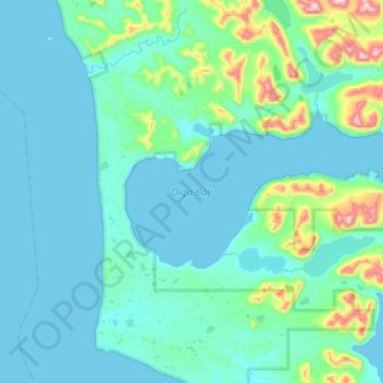
Name: Olga Bay topographic map, elevation, terrain.

Location: Olga Bay, Kodiak Island, Alaska, United States (57.04965 -154.48541 57.16144 -153.97577)

Average elevation: 81 m

Minimum elevation: -6 m

Maximum elevation: 741 m

Other topographic maps

Click on a map to view its topography, its elevation and its terrain.

Kodiak

United States > Alaska > Kodiak Island

Average elevation: 62 m

Kodiak

United States > Alaska > Kodiak Island

Average elevation: 87 m

Gear up for your next adventure:

🔋Emergency Crank Radio - Weather alerts and power without needing batteries
🔭Compact Binoculars - Lightweight optics for scouting trails and wildlife
🧴Bear Spray Holster - Quick-access carry for essential Canadian wilderness safety
🧦Outdoor Socks - Durable socks designed for hiking and outdoor sports
🥾Hiking Shorts - Breathable shorts suitable for summer hikes

As an Amazon Associate, this site earns from qualifying purchases at no extra cost to you.