Geolocate

Aireys Inlet topographic map

Click on the map to display elevation.

About this map

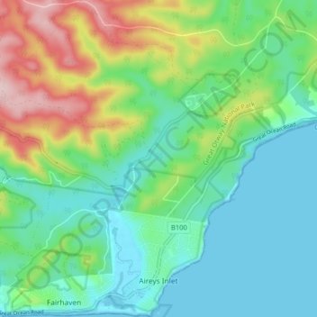
Name: Aireys Inlet topographic map, elevation, terrain.

Location: Aireys Inlet, Surf Coast Shire, Victoria, 3231, Australia (-38.46934 144.06405 -38.40649 144.13091)

Average elevation: 69 m

Minimum elevation: -1 m

Maximum elevation: 238 m

Other topographic maps

Click on a map to view its topography, its elevation and its terrain.

Painkalac Creek

Australia > Victoria > Aireys Inlet > Moggs Creek

Average elevation: 100 m

Gear up for your next adventure:

🧥Waterproof Pants - Keep dry during rainy hiking conditions
🎒Hiking Daypack - Lightweight and durable backpacks for day trips and excursions
🪜Heavy Duty Carabiners - Multi-use clips for securing gear to your backpack
🕶️Polarized Sunglasses - Reduces glare from snow and water at high elevations
🥾Trail Hiking Shoes - Durable shoes designed for rugged trails

As an Amazon Associate, this site earns from qualifying purchases at no extra cost to you.