Geolocate

Steenwijk topographic map

Click on the map to display elevation.

About this map

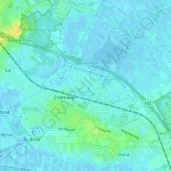
Name: Steenwijk topographic map, elevation, terrain.

Location: Steenwijk, Steenwijkerland, Overijssel, Netherlands (52.77289 6.08491 52.81185 6.16248)

Average elevation: 4 m

Minimum elevation: -3 m

Maximum elevation: 21 m

Other topographic maps

Click on a map to view its topography, its elevation and its terrain.

Enschede

Netherlands > Overijssel > Enschede

Average elevation: 34 m

Witteberg

Netherlands > Overijssel

Average elevation: 57 m

Zuurberg

Netherlands > Overijssel > Holten

Average elevation: 17 m

Tankenberg

Netherlands > Overijssel > de Lutte

Average elevation: 58 m

Helhuizen

Netherlands > Overijssel > Holten

Average elevation: 20 m

Usselo

Netherlands > Overijssel > Enschede

Average elevation: 31 m

Frankhuis

Netherlands > Overijssel > Zwolle

Average elevation: 3 m

Gear up for your next adventure:

🧥Thermal Fleece Jacket - Versatile insulation for changing mountain temperatures
🥾Trekking Boots - Durable boots for long-distance trekking
🛌Insulated Sleeping Pad - Critical thermal barrier between you and the cold ground
💡Portable Camping Lamp - Rechargeable lamp for campsite lighting
🧥Waterproof Pants - Keep dry during rainy hiking conditions

As an Amazon Associate, this site earns from qualifying purchases at no extra cost to you.