Geolocate

Gazole topographic map

Click on the map to display elevation.

About this map

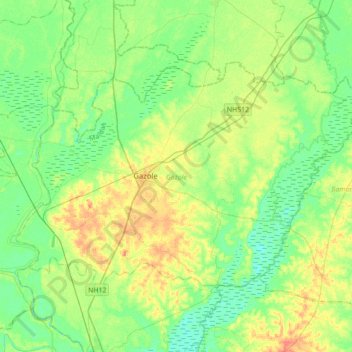
Name: Gazole topographic map, elevation, terrain.

Location: Gazole, Maldah, West Bengal, India (25.11269 88.06508 25.31765 88.41338)

Average elevation: 29 m

Minimum elevation: 15 m

Maximum elevation: 53 m

Other topographic maps

Click on a map to view its topography, its elevation and its terrain.

Mahanagar

India > West Bengal > Gazole > Mahanagar

Average elevation: 31 m

Gear up for your next adventure:

💧Hydration Bladder - Hands-free hydration solution for long treks
🥾All-Terrain Hiking Boots - Versatile boots for varied hiking conditions
🥾Waterproof Hiking Boots - Essential footwear for rugged terrain and wet Canadian trails
Camping Groundsheet - Protect your tent from moisture and dirt
🧴Bear Spray Holster - Quick-access carry for essential Canadian wilderness safety

As an Amazon Associate, this site earns from qualifying purchases at no extra cost to you.