Geolocate

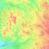
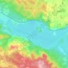
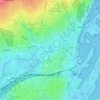
Alken topographic map

Click on the map to display elevation.

About this map

Name: Alken topographic map, elevation, terrain.

Location: Alken, Skanderborg Municipality, Central Denmark Region, Denmark (56.03197 9.82558 56.07197 9.86558)

Average elevation: 45 m

Minimum elevation: 17 m

Maximum elevation: 104 m

Other topographic maps

Click on a map to view its topography, its elevation and its terrain.
Øby

Denmark > Central Denmark Region

Average elevation: 15 m

Anholt

Denmark > Central Denmark Region

The western fifth of Anholt consists of hilly moraine country, while the eastern four-fifths of the island consist of mostly flat raised seabed with some low hills, former wind-blown sand dunes. Only the western moraine hills are inhabited. The eastern part, called "Ørkenen" (The Desert) is treeless; the…

Average elevation: 2 m
Samsø

Denmark > Central Denmark Region

Average elevation: 2 m
Karup Å

Denmark > Central Denmark Region

Average elevation: 57 m

Julsø

Denmark > Central Denmark Region > Laven

Average elevation: 65 m

Rimsø

Denmark > Central Denmark Region

Average elevation: 32 m

Glesborg

Denmark > Central Denmark Region

Average elevation: 39 m

Begtrup Vig

Denmark > Central Denmark Region

Average elevation: 9 m

Nørrestrand

Denmark > Central Denmark Region > Horsens

Average elevation: 14 m

Tunø

Denmark > Central Denmark Region

Average elevation: 2 m
Mølleparken

Denmark > Central Denmark Region > Aarhus

Average elevation: 17 m

Gear up for your next adventure:

👟Trail Running Shoes - Agile footwear for fast-paced topographic exploration
💧Hydration Pack - Hands-free hydration system for long hikes
🧭GPS Tracker - Track your location in remote areas safely
🗺️Topographic Maps - Detailed maps to explore trails, mountains, and wilderness areas
🥾Hiking Leggings - Comfortable leggings for outdoor activities

As an Amazon Associate, this site earns from qualifying purchases at no extra cost to you.