Geolocate

Higher Eype topographic map

Click on the map to display elevation.

About this map

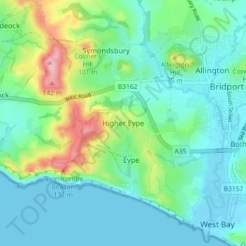
Name: Higher Eype topographic map, elevation, terrain.

Location: Higher Eype, Dorset, England, DT6 6AT, United Kingdom (50.70782 -2.80556 50.74782 -2.76556)

Average elevation: 37 m

Minimum elevation: -3 m

Maximum elevation: 153 m

Gear up for your next adventure:

🥾Hiking Gaiters - Protect legs and shoes from mud, snow, and debris
🛰️Satellite Messenger - Emergency communication for areas with no cell service
🧴Insect Repellent - Protect yourself from bugs during outdoor adventures
🧰Multitool Knife - Compact and versatile tool for outdoor use
👟Trail Running Shoes - Agile footwear for fast-paced topographic exploration

As an Amazon Associate, this site earns from qualifying purchases at no extra cost to you.