Geolocate

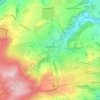
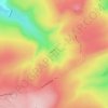
Holme Moss topographic map

Click on the map to display elevation.

About this map
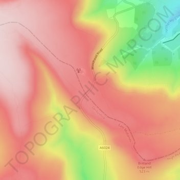
Name: Holme Moss topographic map, elevation, terrain.

Location: Holme Moss, Holme Valley, Kirklees, West Yorkshire, England, HD9 2QH, United Kingdom (53.53022 -1.85533 53.53032 -1.85523)

Average elevation: 467 m

Minimum elevation: 252 m

Maximum elevation: 575 m

Other topographic maps

Click on a map to view its topography, its elevation and its terrain.
Kirkburton

United Kingdom > England > Kirklees

Average elevation: 148 m

Meltham

United Kingdom > England > Kirklees

Average elevation: 278 m

Holme Valley

United Kingdom > England > Kirklees > Holmfirth

Average elevation: 290 m

Crow Nest Park

United Kingdom > England > Kirklees > Dewsbury

Average elevation: 64 m

Holmfirth Branch

United Kingdom > England > Kirklees > Brockholes

Average elevation: 185 m

Mirfield

United Kingdom > England > Kirklees > Lower Hopton

Average elevation: 97 m

Denby Dale

United Kingdom > England > Kirklees > Scissett

Average elevation: 168 m

Greenhead Park

United Kingdom > England > Kirklees > Huddersfield

Average elevation: 119 m

Hey Wood

United Kingdom > England > Kirklees > Farnley Tyas

Average elevation: 186 m

Denby Dale

United Kingdom > England > Kirklees

Average elevation: 187 m

Gear up for your next adventure:

🧊Portable Cooler - Keep food and drinks cold during outdoor adventures
💧Hydration Bladder - Hands-free hydration solution for long treks
🥾Trail Hiking Boots - Supportive boots for rough trails
🧥Packable Rain Jacket - Breathable waterproof layer for unpredictable weather
🌡️Emergency Mylar Blankets - Compact thermal protection for unexpected nights outdoors

As an Amazon Associate, this site earns from qualifying purchases at no extra cost to you.