Geolocate

Poolway topographic map

Click on the map to display elevation.

About this map

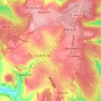
Name: Poolway topographic map, elevation, terrain.

Location: Poolway, Coleford, Forest of Dean, Gloucestershire, England, GL16 8DF, United Kingdom (51.77600 -2.63241 51.81600 -2.59241)

Average elevation: 197 m

Minimum elevation: 98 m

Maximum elevation: 235 m

Other topographic maps

Click on a map to view its topography, its elevation and its terrain.

Gear up for your next adventure:

🥾Waterproof Hiking Boots - Essential footwear for rugged terrain and wet Canadian trails
🧢Hiking Sun Hat - Wide-brimmed protection for exposed mountain ridges
🛶Kayak Accessories - Essential gear for safe and fun kayaking adventures
🧤Rechargeable Heated Gloves - Extreme warmth for Canadian winter expeditions
🥾Waterproof Hiking Shoes - Durable shoes for wet and rugged trails

As an Amazon Associate, this site earns from qualifying purchases at no extra cost to you.