
Kaohsiung topographic map
Interactive map
Click on the map to display elevation.
About this map
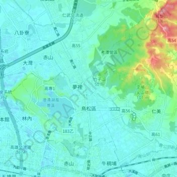
Name: Kaohsiung topographic map, elevation, terrain.
Location: Kaohsiung, Niaosong District, 833, Taiwan (22.63779 120.33083 22.69660 120.40286)
Average elevation: 30 m
Minimum elevation: 6 m
Maximum elevation: 146 m
Other topographic maps
Click on a map to view its topography, its elevation and its terrain.