
Make a donation
Gear up for your next adventure:
As an Amazon Associate, this site earns from qualifying purchases at no extra cost to you.
Genhausen topographic map
Click on the map to display elevation.
Make a donation
Gear up for your next adventure:
As an Amazon Associate, this site earns from qualifying purchases at no extra cost to you.
About this map
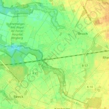
Name: Genhausen topographic map, elevation, terrain.
Average elevation: 70 m
Minimum elevation: 56 m
Maximum elevation: 81 m
Make a donation
Gear up for your next adventure:
As an Amazon Associate, this site earns from qualifying purchases at no extra cost to you.
Other topographic maps
Click on a map to view its topography, its elevation and its terrain.
Make a donation
Gear up for your next adventure:
As an Amazon Associate, this site earns from qualifying purchases at no extra cost to you.
Rheindahlen-Mitte
Deutschland > Nordrhein-Westfalen > Mönchengladbach
Insgesamt 16 Brunnen liefern das Trinkwasser für das Wasserwerk. Das Wasserwerk wurde auf dem höchsten Punkt zwischen Rheindahlen und der Honschaft Hilderath errichtet. In den Jahren 1921, 1927, 1936 und 1942 musste das Wasserwerk auf seine heutige Größe erweitert werden, da in den umliegenden Ortschaften…
Average elevation: 75 m
Make a donation
Gear up for your next adventure:
As an Amazon Associate, this site earns from qualifying purchases at no extra cost to you.
Venn
Deutschland > Nordrhein-Westfalen > Mönchengladbach
Gebaut wurde die Kirche von Baumeister der Neugotik Vincenz Statz. In Kreuzform errichtet, hatte sie eine Länge von 105 Fuß, eine Höhe von 34 Fuß und einen Durchschnitt von 46 Fuß.
Average elevation: 74 m
Make a donation
Gear up for your next adventure:
As an Amazon Associate, this site earns from qualifying purchases at no extra cost to you.
Hardt-Mitte
Deutschland > Nordrhein-Westfalen > Mönchengladbach
Das Toponym Hardt als Flurnamenbezeichnung stammt aus dem Althochdeutschen und bedeutet bewaldeter Hang oder Anhöhe.
Average elevation: 72 m
Make a donation
Gear up for your next adventure:
As an Amazon Associate, this site earns from qualifying purchases at no extra cost to you.