Geolocate

Oompah Tower topographic map

Click on the map to display elevation.

About this map

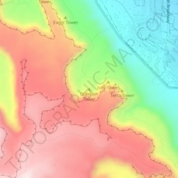
Name: Oompah Tower topographic map, elevation, terrain.

Location: Oompah Tower, Mesa County, Colorado, 81507, United States (39.07009 -108.68431 39.07019 -108.68421)

Average elevation: 1,708 m

Minimum elevation: 1,437 m

Maximum elevation: 1,941 m

Other topographic maps

Click on a map to view its topography, its elevation and its terrain.

Redlands

United States > Colorado > Mesa County

Average elevation: 1,607 m

4 Road

United States > Colorado > Mesa County

Average elevation: 1,445 m

Gear up for your next adventure:

🥾Trekking Poles - Adjustable trekking poles to reduce knee stress and improve stability
🥽Outdoor Goggles - Protective eyewear for outdoor activities
Bushcraft Tarp - Versatile emergency shelter or gear protection
🥾Lightweight Hiking Shoes - Comfortable shoes for day hikes
🧥Waterproof Pants - Keep dry during rainy hiking conditions

As an Amazon Associate, this site earns from qualifying purchases at no extra cost to you.