Geolocate

Myeik topographic map

Click on the map to display elevation.

About this map

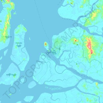
Name: Myeik topographic map, elevation, terrain.

Location: Myeik, Myeik District, Tanintharyi Region, 00195, Myanmar (12.27196 98.43557 12.59196 98.75557)

Average elevation: 9 m

Minimum elevation: -3 m

Maximum elevation: 286 m

Other topographic maps

Click on a map to view its topography, its elevation and its terrain.

Gear up for your next adventure:

💡Portable Camping Lamp - Rechargeable lamp for campsite lighting
🧢Hiking Hat - Sun-protective and breathable hats for long treks
🧊Portable Cooler - Keep food and drinks cold during outdoor adventures
🧰Emergency Multi-Tool - Compact multi-tool for outdoor survival
🛁Quick-Dry Microfiber Towel - Space-saving towel that dries rapidly on the move

As an Amazon Associate, this site earns from qualifying purchases at no extra cost to you.