Geolocate

Marseilles topographic map

Click on the map to display elevation.

About this map

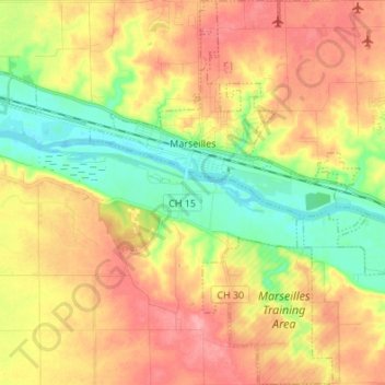
Name: Marseilles topographic map, elevation, terrain.

Location: Marseilles, LaSalle County, Illinois, 61341, United States (41.26701 -88.74441 41.36861 -88.63784)

Average elevation: 189 m

Minimum elevation: 143 m

Maximum elevation: 234 m

Other topographic maps

Click on a map to view its topography, its elevation and its terrain.

Wedron

United States > Illinois > LaSalle County

Average elevation: 179 m

Hitt

United States > Illinois > LaSalle County > Ottawa

Average elevation: 174 m

Dayton

United States > Illinois > LaSalle County

Average elevation: 179 m

Serena

United States > Illinois > LaSalle County

Average elevation: 192 m

Gear up for your next adventure:

🔥Camping Stove - Portable stoves to cook outdoors with ease
🎒Backpack Rain Cover - External shield to keep your entire pack dry
🚲MTB Frame Bag - Carry tools and maps directly on your bicycle frame
🧭GPS Outdoor Watch - Smart watch for navigation and fitness tracking in nature
🥾Light Trekking Boots - Supportive boots for multi-day treks

As an Amazon Associate, this site earns from qualifying purchases at no extra cost to you.