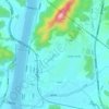
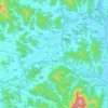
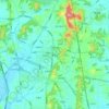
Daejeon topographic map
Click on the map to display elevation.
Daejeon
In 1973, Buk-myeon and Yuseong-myeon of Daedeok-gun were each elevated to Sintanjin-eup and Yuseong-eup, respectively. In 1977, the ward system (gu-je) was implemented in Daejeon, establishing two wards: Jung-gu and Dong-gu. In 1983, Daejeon further expanded by incorporating the entire areas of Yuseong-eup and Hoedeok-myeon of Daedeok-gun, and parts of Tan-dong, Gujeok, Jinjam, and Giseong-myeon. At this time, Daedeok-gun was split into two separate parts. This situation continued until 1989, when Daedeok-gun was abolished and Daejeon was elevated to a Directly Governed City. Just before this elevation in 1988, Seo-gu was separated from Jung-gu. In 1989, Daedeok-gun was abolished and merged into Daejeon, and the integrated Daejeon of Chungcheongnam-do was elevated to Daejeon Directly Governed City. Simultaneously, Yuseong District was separated from Seo-gu, and Daedeok District from Dong-gu, completing the current system of five districts.
About this map

Name: Daejeon topographic map, elevation, terrain.
Location: Daejeon, South Korea (36.18337 127.24632 36.50021 127.54087)
Average elevation: 159 m
Minimum elevation: 7 m
Maximum elevation: 880 m
Other topographic maps
Click on a map to view its topography, its elevation and its terrain.




Hallasan
The occurrence of the highest temperature coincides with the formation position of the eddy, and when the wind is weak, the eddy forms in the middle mountain region. When the wind is weak, the warmth is accumulated in the middle layer, so the maximum temperature in the mid-mountainous area is higher than the…
Average elevation: 1,652 m


Hallasan
The occurrence of the highest temperature coincides with the formation position of the eddy, and when the wind is weak, the eddy forms in the middle mountain region. When the wind is weak, the warmth is accumulated in the middle layer, so the maximum temperature in the mid-mountainous area is higher than the…
Average elevation: 1,652 m




Gimcheon
Mt. Hwangaksan (1,111m in elevation), home of Jikjisa, is located in the Sobaeksan Mountains. The area is a habitat for many cranes that reside on this mountain. This location is also known for its pine forests, streams, fall foliage and snowscapes.
Average elevation: 263 m


Dokdo-ri
The Liancourt Rocks, known in Korea as Dokdo (Korean: 독도) and in Japan as Takeshima (Japanese: 竹島), are a group of islets in the Sea of Japan between the Korean Peninsula and the Japanese archipelago administered by South Korea. The Liancourt Rocks comprise two main islets and 35 smaller rocks; the…
Average elevation: 0 m
















Hallasan
The occurrence of the highest temperature coincides with the formation position of Eddy, and when the wind is weak, it is formed in the middle mountain region. When the wind is weak, the warmth is accumulated in the middle layer, so the maximum temperature in the mid-mountainous area is higher than the maximum…
Average elevation: 1,652 m
Turczaninow Hornbeam Tree at Chamseongdan Altar
South Korea > Ganghwa-gun > Incheon > Hwado-myeon
Average elevation: 155 m