
Thank you for supporting this site ❤️
Make a donation
Make a donation
Gear up for your next adventure:
As an Amazon Associate, this site earns from qualifying purchases at no extra cost to you.
Hyangnam topographic map
Click on the map to display elevation.
Thank you for supporting this site ❤️
Make a donation
Make a donation
Gear up for your next adventure:
As an Amazon Associate, this site earns from qualifying purchases at no extra cost to you.
About this map
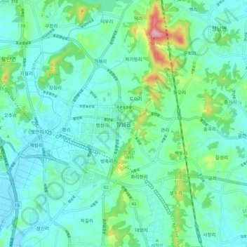
Name: Hyangnam topographic map, elevation, terrain.
Location: Hyangnam, Hwaseong-si, Gyeonggi, 18600, South Korea (37.08940 126.89252 37.16940 126.97252)
Average elevation: 48 m
Minimum elevation: 3 m
Maximum elevation: 234 m
Thank you for supporting this site ❤️
Make a donation
Make a donation
Gear up for your next adventure:
As an Amazon Associate, this site earns from qualifying purchases at no extra cost to you.