
Mambog topographic map
Click on the map to display elevation.
About this map
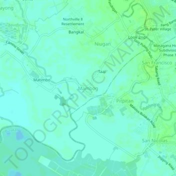
Name: Mambog topographic map, elevation, terrain.
Location: Mambog, Bulacan, Central Luzon, 3017, Philippines (14.78999 120.83129 14.82999 120.87129)
Average elevation: 4 m
Minimum elevation: -1 m
Maximum elevation: 9 m
Other topographic maps
Click on a map to view its topography, its elevation and its terrain.
Pulilan
The municipality is generally of flat topography. Eleven (11) of its barangays are bounded by the Angat River. The rest are flat irrigated rice lands. Soil types vary from sandy loam to clay loam which makes the municipality suitable to a wide range of agricultural products.
Average elevation: 10 m
Obando
Flat and low-lying coastal plains characterize the general topography of Obando. The area was formerly an estuary, but it filled up partially from the peripheral parts of each sand bar and sand spit and formed up into current figure that mainly consisted of commercial district, partly industrial district,…
Average elevation: 4 m