Geolocate

Paombong topographic map

Click on the map to display elevation.

About this map

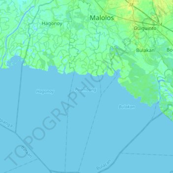
Name: Paombong topographic map, elevation, terrain.

Location: Paombong, Bulacan, Central Luzon, 3001, Philippines (14.60998 120.75368 14.87046 120.81017)

Average elevation: 2 m

Minimum elevation: -2 m

Maximum elevation: 11 m

Gear up for your next adventure:

🧥Softshell Jacket - Windproof and breathable jacket for hiking
🧭GPS Handheld Device - Reliable GPS navigation for outdoor adventures
Camping Groundsheet - Protect your tent from moisture and dirt
🎒Hiking Backpack - Lightweight and ergonomic backpacks for day hikes or multi-day treks
🛶Waterproof Dry Bags - Keep electronics and clothes dry during river crossings

As an Amazon Associate, this site earns from qualifying purchases at no extra cost to you.