Geolocate

Del Rosario topographic map

Click on the map to display elevation.

About this map

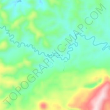
Name: Del Rosario topographic map, elevation, terrain.

Location: Del Rosario, Samar, Eastern Visayas, Philippines (12.19427 124.90963 12.23427 124.94963)

Average elevation: 168 m

Minimum elevation: 60 m

Maximum elevation: 395 m

Other topographic maps

Click on a map to view its topography, its elevation and its terrain.

Guyam Island

Philippines > Samar > Catbalogan

Average elevation: 0 m

Hamlayan

Philippines > Samar > Ulayan

Average elevation: 6 m

Gandara

Philippines > Samar

Average elevation: 126 m

Santa Margarita

Philippines > Samar

Average elevation: 41 m

Ulot River

Philippines > Samar > Balagon

Average elevation: 105 m

Suribao River

Philippines > Samar

Average elevation: 268 m

Gear up for your next adventure:

🕶️Polarized Sunglasses - Reduces glare from snow and water at high elevations
🚲MTB Frame Bag - Carry tools and maps directly on your bicycle frame
❄️Traction Ice Cleats - Slip-on spikes for icy trails and winter hiking
🔨Vehicle Emergency Tool - Safety tool for remote road trips to trailheads
🌡️Emergency Mylar Blankets - Compact thermal protection for unexpected nights outdoors

As an Amazon Associate, this site earns from qualifying purchases at no extra cost to you.