Geolocate

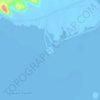
al maadi topographic map

Click on the map to display elevation.

About this map

Name: al maadi topographic map, elevation, terrain.

Location: al maadi, Matruh, Egypt (30.81434 29.21029 30.85434 29.25029)

Average elevation: 4 m

Minimum elevation: -5 m

Maximum elevation: 24 m

Other topographic maps

Click on a map to view its topography, its elevation and its terrain.
Siwa Oasis

Egypt > Matruh > Siwa Oasis

Average elevation: -8 m

Siwa Oasis

Egypt > Matruh > Siwa Oasis

Average elevation: -8 m

Mountainview Ras El Hekma

Egypt > Matruh

Average elevation: 12 m

Misr for Construction Village

Egypt > Matruh

Average elevation: 6 m

Mountainview Ras El Hekma

Egypt > Matruh

Average elevation: 12 m

Porto Golf Marina

Egypt > Matruh

Average elevation: 7 m

Fatnis Island

Egypt > Matruh > Siwa Oasis

Average elevation: -15 m

Mountainview Ras El Hekma

Egypt > Matruh

Average elevation: 12 m

Sidi Abdelrahman

Egypt > Matruh

Average elevation: 12 m

Mountainview Ras El Hekma

Egypt > Matruh

Average elevation: 12 m

Borg Al Arab City

Egypt > Matruh > New Borg el-Arab

Average elevation: 27 m

Taghaghien Island

Egypt > Matruh > Siwa Oasis

Average elevation: -15 m

Marina el-Alamein

Egypt > Matruh > El Alamein

Average elevation: 4 m

Wadi Delga

Egypt > Matruh

Average elevation: 7 m

El Omayed Protectorate

Egypt > Matruh

Average elevation: 45 m

Al Sallom City

Egypt > Matruh

Average elevation: 155 m

Seashell

Egypt > Matruh

Average elevation: 6 m

New Borg el-Arab

Egypt > Matruh

Average elevation: 40 m

Gear up for your next adventure:

🥾Trail Running Boots - Durable shoes designed for trail running
🥾Trail Hiking Socks - Comfortable socks to prevent blisters and fatigue
🥾Hiking Leggings - Comfortable leggings for outdoor activities
💡LED Camping Lantern - Illuminate your campsite with long-lasting lanterns
❄️Traction Ice Cleats - Slip-on spikes for icy trails and winter hiking

As an Amazon Associate, this site earns from qualifying purchases at no extra cost to you.