Geolocate

Taghaghien Island topographic map

Click on the map to display elevation.

About this map

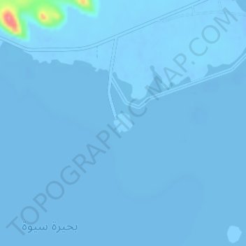
Name: Taghaghien Island topographic map, elevation, terrain.

Location: Taghaghien Island, Siwa Oasis, Matruh, Egypt (29.22412 25.46636 29.22629 25.46881)

Average elevation: -15 m

Minimum elevation: -19 m

Maximum elevation: 79 m

Other topographic maps

Click on a map to view its topography, its elevation and its terrain.

Cleopatra's bath

Egypt > Matruh > Siwa Oasis

Average elevation: -10 m

Siwa Oasis

Egypt > Matruh > Siwa Oasis

Average elevation: -8 m

Siwa Oasis

Egypt > Matruh > Siwa Oasis

Average elevation: -8 m

Fort Shally top view

Egypt > Matruh > Siwa Oasis

Average elevation: -12 m

Hot Spring

Egypt > Matruh > Siwa Oasis

Average elevation: 49 m

Gear up for your next adventure:

👟Leg Gaiters - Keep debris, mud, and snow out of your boots
🦯Trekking Poles - Reduced impact on joints for steep topographic climbs
🥾Waterproof Hiking Shoes - Durable shoes for wet and rugged trails
Tent Footprint - Protect tent floor and increase durability
🛏️Camping Sleeping Mat - Comfortable mats for sleeping outdoors

As an Amazon Associate, this site earns from qualifying purchases at no extra cost to you.