
Waeperang topographic map
Interactive map
Click on the map to display elevation.
About this map
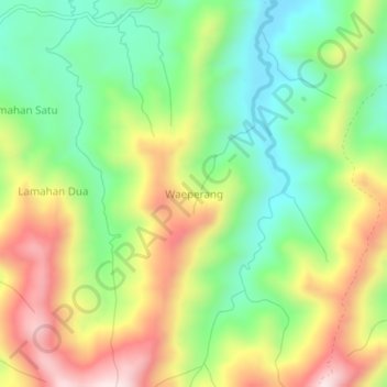
Name: Waeperang topographic map, elevation, terrain.
Location: Waeperang, Buru, Moluques, Indonésie (-3.20849 126.83468 -3.16849 126.87468)
Average elevation: 257 m
Minimum elevation: 39 m
Maximum elevation: 557 m
Other topographic maps
Click on a map to view its topography, its elevation and its terrain.