Geolocate

Morar topographic map

Click on the map to display elevation.

About this map

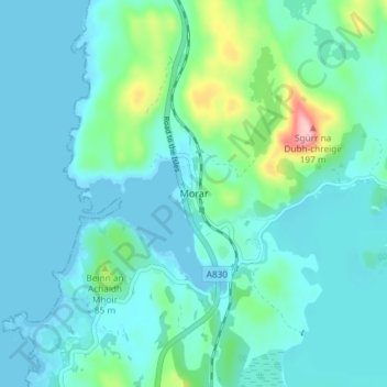
Name: Morar topographic map, elevation, terrain.

Location: Morar, Highland, Scotland, PH40 4PH, United Kingdom (56.95062 -5.84350 56.99062 -5.80350)

Average elevation: 30 m

Minimum elevation: 0 m

Maximum elevation: 189 m

Other topographic maps

Click on a map to view its topography, its elevation and its terrain.

Loch Ness

United Kingdom > Scotland > Highland > Dores

Average elevation: 340 m

Gear up for your next adventure:

🔭Compact Binoculars - Lightweight optics for scouting trails and wildlife
🧥Waterproof Pants - Keep dry during rainy hiking conditions
🥾Hiking Gaiters - Protect legs and shoes from mud, snow, and debris
🛏️Sleeping Bag - Warm and compact sleeping bags for outdoor camping
🥾Hiking Leggings - Comfortable leggings for outdoor activities

As an Amazon Associate, this site earns from qualifying purchases at no extra cost to you.