Geolocate

Ikutha topographic map

Click on the map to display elevation.

About this map

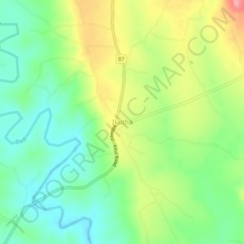
Name: Ikutha topographic map, elevation, terrain.

Location: Ikutha, Kitui South, Kitui County, Eastern, Kenya (-2.08503 38.15930 -2.04503 38.19930)

Average elevation: 696 m

Minimum elevation: 651 m

Maximum elevation: 767 m

Other topographic maps

Click on a map to view its topography, its elevation and its terrain.

Mutomo

Kenya > Kitui County > Kitui South

Average elevation: 904 m

Gear up for your next adventure:

💡Compact LED Flashlight - Powerful and portable flashlight for outdoor use
🥾Waterproof Hiking Boots - Essential footwear for rugged terrain and wet Canadian trails
🥾Hiking Shorts - Breathable shorts suitable for summer hikes
🥾Mountain Hiking Shoes - Shoes with superior grip for mountainous terrain
🥤Collapsible Travel Cup - Saves space and weight in your mess kit

As an Amazon Associate, this site earns from qualifying purchases at no extra cost to you.