Geolocate

Ytterby topographic map

Click on the map to display elevation.

About this map

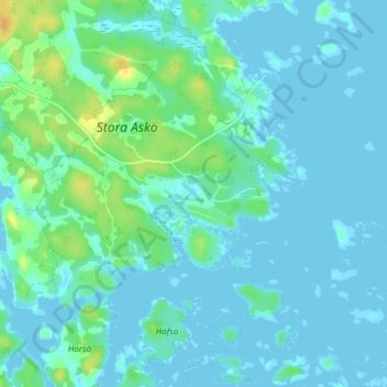
Name: Ytterby topographic map, elevation, terrain.

Location: Ytterby, Västerviks kommun, Kalmar County, Sweden (57.95560 16.77333 57.99560 16.81333)

Average elevation: 5 m

Minimum elevation: -4 m

Maximum elevation: 27 m

Other topographic maps

Click on a map to view its topography, its elevation and its terrain.

Emmaboda kommun

Sweden > Kalmar County

Average elevation: 141 m

Hansa City

Sweden > Kalmar County

Average elevation: 7 m

Högsby kommun

Sweden > Kalmar County

Average elevation: 97 m

Nybro kommun

Sweden > Kalmar County

Average elevation: 109 m

Hultsfreds kommun

Sweden > Kalmar County

Average elevation: 143 m

Store Hindsjön

Sweden > Kalmar County

Average elevation: 118 m

Mönsterås kommun

Sweden > Kalmar County

Average elevation: 26 m

Alen

Sweden > Kalmar County

Average elevation: 142 m

Emmaboda kommun

Sweden > Kalmar County

Average elevation: 141 m

Oskarshamns kommun

Sweden > Kalmar County

Average elevation: 63 m

Kalmar kommun

Sweden > Kalmar County

Average elevation: 28 m

Gear up for your next adventure:

💧Hydration Pack - Hands-free hydration system for long hikes
🧢Hiking Sun Hat - Wide-brimmed protection for exposed mountain ridges
🥫Freeze-Dried Meals - Lightweight, high-calorie nutrition for multi-day treks
🧰Survival Kit - Essential gear for emergencies in the wilderness
🧤Thermal Hiking Gloves - Grip-enhanced gloves for cold-weather altitude trekking

As an Amazon Associate, this site earns from qualifying purchases at no extra cost to you.