
Kaltenkirchen topographic map
Interactive map
Click on the map to display elevation.
About this map
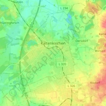
Name: Kaltenkirchen topographic map, elevation, terrain.
Location: Kaltenkirchen, Kreis Segeberg, Schleswig-Holstein, Deutschland (53.80209 9.86487 53.85882 9.98738)
Average elevation: 32 m
Minimum elevation: 11 m
Maximum elevation: 65 m
Other topographic maps
Click on a map to view its topography, its elevation and its terrain.
Bornhöved
Deutschland > Schleswig-Holstein > Kreis Segeberg
Bornhöved, Kreis Segeberg, Schleswig-Holstein, 24619, Deutschland
Average elevation: 46 m