Geolocate

Searcy topographic map

Click on the map to display elevation.

About this map

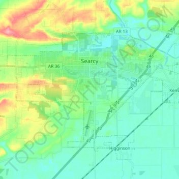
Name: Searcy topographic map, elevation, terrain.

Location: Searcy, White County, Arkansas, United States (35.19499 -91.80108 35.26953 -91.66087)

Average elevation: 84 m

Minimum elevation: 58 m

Maximum elevation: 158 m

Other topographic maps

Click on a map to view its topography, its elevation and its terrain.

Romance

United States > Arkansas > White County

Average elevation: 192 m

El Paso

United States > Arkansas > White County > El Paso

Average elevation: 103 m

Gear up for your next adventure:

🔭Outdoor Binoculars - Lightweight binoculars for birdwatching and hiking
🚑Survival Whistle - Signal for help across long distances in mountains
💧Hydration Pack - Hands-free hydration system for long hikes
🧢Sun Hat - Wide-brim hat for sun protection
🧶550 Survival Paracord - Versatile utility cord for emergency repairs and rigging

As an Amazon Associate, this site earns from qualifying purchases at no extra cost to you.