
Hamlet of Carbondale topographic map
Interactive map
Click on the map to display elevation.
About this map
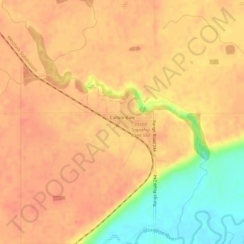
Name: Hamlet of Carbondale topographic map, elevation, terrain.
Location: Hamlet of Carbondale, Sturgeon County, Alberta, Canada (53.74053 -113.53342 53.74826 -113.52089)
Average elevation: 681 m
Minimum elevation: 647 m
Maximum elevation: 693 m