
Hemnes topographic map
Interactive map
Click on the map to display elevation.
About this map
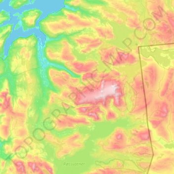
Name: Hemnes topographic map, elevation, terrain.
Location: Hemnes, Nordland, Norway (65.76583 13.33380 66.25693 14.60231)
Average elevation: 611 m
Minimum elevation: -1 m
Maximum elevation: 1,860 m
Other topographic maps
Click on a map to view its topography, its elevation and its terrain.
Ballangen - Bálák
Ballangen - Bálák, Narvik, Nordland, Norway
Average elevation: 91 m
Stuorgiedde - Storjorda
Stuorgiedde - Storjorda, Hamarøy, Nordland, 8275, Norway
Average elevation: 42 m