
Loftus topographic map
Interactive map
Click on the map to display elevation.
About this map
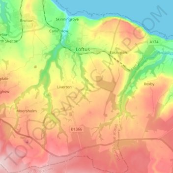
Name: Loftus topographic map, elevation, terrain.
Average elevation: 142 m
Minimum elevation: 0 m
Maximum elevation: 281 m
Other topographic maps
Click on a map to view its topography, its elevation and its terrain.
Scaling Dam
United Kingdom > England > Redcar and Cleveland > Loftus > Scaling
Scaling Dam, Scaling, Loftus, Redcar and Cleveland, Tees Valley, England, TS13 4TP, United Kingdom
Average elevation: 192 m