Geolocate

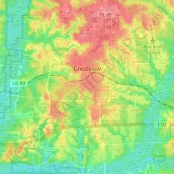
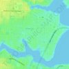
Crestview topographic map

Click on the map to display elevation.

Crestview

Crestview is the largest city and county seat of Okaloosa County, Florida, United States. The population was 27,134 at the 2020 census, up from 20,978 at the 2010 census. With an elevation of 236 feet (72 m) above sea level, it is one of the highest points in the state.

Wikipedia (CC-BY-SA 3.0)

About this map

Name: Crestview topographic map, elevation, terrain.

Location: Crestview, Okaloosa County, Florida, United States (30.69569 -86.63562 30.80514 -86.52671)

Average elevation: 43 m

Minimum elevation: 10 m

Maximum elevation: 89 m

Other topographic maps

Click on a map to view its topography, its elevation and its terrain.
Deerland

United States > Florida > Okaloosa County

Average elevation: 63 m

Holt

United States > Florida > Okaloosa County

Average elevation: 53 m

Holt

United States > Florida > Okaloosa County

Average elevation: 53 m

Gear up for your next adventure:

🧦Hiking Liner Socks - Thin base layer to prevent friction and blisters
🚲MTB Frame Bag - Carry tools and maps directly on your bicycle frame
🧼Travel Hand Sanitizer - Keep hands clean when water is scarce
🥽Outdoor Goggles - Protective eyewear for outdoor activities
❄️Traction Ice Cleats - Slip-on spikes for icy trails and winter hiking

As an Amazon Associate, this site earns from qualifying purchases at no extra cost to you.