Geolocate

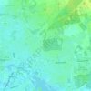
Vreden topographic map

Click on the map to display elevation.

About this map

Name: Vreden topographic map, elevation, terrain.

Location: Vreden, Kreis Borken, North Rhine-Westphalia, 48691, Germany (51.99353 6.68674 52.12807 6.91097)

Average elevation: 41 m

Minimum elevation: 23 m

Maximum elevation: 79 m

Other topographic maps

Click on a map to view its topography, its elevation and its terrain.

Anholt

Germany > North Rhine-Westphalia > Kreis Borken

Average elevation: 18 m

W10

Germany > North Rhine-Westphalia > Kreis Borken > Bocholt

Average elevation: 32 m

W5

Germany > North Rhine-Westphalia > Kreis Borken > Bocholt

Average elevation: 32 m

Gear up for your next adventure:

🥾Lightweight Hiking Shoes - Comfortable shoes for day hikes
🧥Waterproof Jacket - Lightweight rain jackets for hiking and outdoor activities
🕶️Polarized Sunglasses - Protect your eyes with durable polarized lenses
🧥Thermal Layer - Insulating layer for cold outdoor conditions
🔦UV Flashlight - Detect minerals or specific insects in the dark

As an Amazon Associate, this site earns from qualifying purchases at no extra cost to you.