Geolocate

Bocholt topographic map

Click on the map to display elevation.

About this map

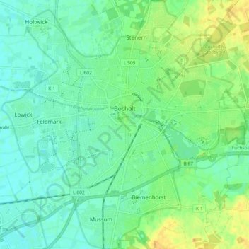
Name: Bocholt topographic map, elevation, terrain.

Location: Bocholt, Kreis Borken, North Rhine-Westphalia, Germany (51.80627 6.56973 51.86282 6.65970)

Average elevation: 28 m

Minimum elevation: 19 m

Maximum elevation: 45 m

Gear up for your next adventure:

🥾Approach Boots - Comfortable boots for hiking and climbing approaches
🥾Lightweight Hiking Boots - Boots for comfort and mobility on long hikes
Camping Tent - Weather-resistant tents suitable for 2 to 6 people
🧰Survival Kit - Essential gear for emergencies in the wilderness
🥘Camping Cookware Set - Compact nesting pots and pans for trail cooking

As an Amazon Associate, this site earns from qualifying purchases at no extra cost to you.