Geolocate

Keer topographic map

Click on the map to display elevation.

About this map
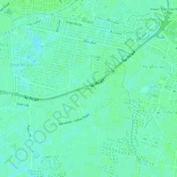
Name: Keer topographic map, elevation, terrain.

Location: Keer, Model Town Tehsil, Lahore District, Lahore Division, Punjab, 54910, Pakistan (31.43292 74.39333 31.47292 74.43333)

Average elevation: 214 m

Minimum elevation: 210 m

Maximum elevation: 217 m

Other topographic maps

Click on a map to view its topography, its elevation and its terrain.

Race Course Park

Pakistan > Punjab > Lahore District > Lahore

Average elevation: 216 m

Gear up for your next adventure:

🛏️Camping Sleeping Mat - Comfortable mats for sleeping outdoors
🥾All-Terrain Hiking Boots - Versatile boots for varied hiking conditions
🧥Insulated Jacket - Keep warm in cold outdoor conditions
🪜Heavy Duty Carabiners - Multi-use clips for securing gear to your backpack
🥾Light Trekking Boots - Supportive boots for multi-day treks

As an Amazon Associate, this site earns from qualifying purchases at no extra cost to you.