Geolocate

Tomah topographic map

Click on the map to display elevation.

About this map

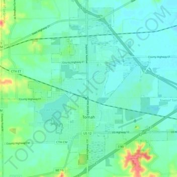
Name: Tomah topographic map, elevation, terrain.

Location: Tomah, Monroe County, Wisconsin, 54660, United States (43.95434 -90.53800 44.02601 -90.45966)

Average elevation: 297 m

Minimum elevation: 282 m

Maximum elevation: 353 m

Other topographic maps

Click on a map to view its topography, its elevation and its terrain.

Mount Thom

United States > Wisconsin > Monroe County

Average elevation: 341 m

Gear up for your next adventure:

🔨Vehicle Emergency Tool - Safety tool for remote road trips to trailheads
🧥Softshell Jacket - Windproof and breathable jacket for hiking
🔭Compact Binoculars - Lightweight optics for scouting trails and wildlife
🧢Hiking Sun Hat - Wide-brimmed protection for exposed mountain ridges
🚑Survival Whistle - Signal for help across long distances in mountains

As an Amazon Associate, this site earns from qualifying purchases at no extra cost to you.