Geolocate

Fairdale topographic map

Click on the map to display elevation.

About this map

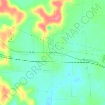
Name: Fairdale topographic map, elevation, terrain.

Location: Fairdale, Harrison County, Indiana, 47166, United States (38.30618 -86.19109 38.34618 -86.15109)

Average elevation: 225 m

Minimum elevation: 197 m

Maximum elevation: 278 m

Other topographic maps

Click on a map to view its topography, its elevation and its terrain.

Lanesville

United States > Indiana > Harrison County

Average elevation: 239 m

New Amsterdam

United States > Indiana > Harrison County

Average elevation: 151 m

New Middletown

United States > Indiana > Harrison County

Average elevation: 215 m

Crandall

United States > Indiana > Harrison County

Average elevation: 217 m

Laconia

United States > Indiana > Harrison County

Average elevation: 201 m

Gear up for your next adventure:

💧Collapsible Water Bottle - Space-saving water bottle for outdoor activities
🧶550 Survival Paracord - Versatile utility cord for emergency repairs and rigging
💧Reusable Water Bottle - Durable water bottles for hydration on trails
🧴Insect Repellent - Protect yourself from bugs during outdoor adventures
🧥Thermal Fleece Jacket - Versatile insulation for changing mountain temperatures

As an Amazon Associate, this site earns from qualifying purchases at no extra cost to you.