Geolocate

Kigumo topographic map

Click on the map to display elevation.

About this map

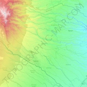
Name: Kigumo topographic map, elevation, terrain.

Location: Kigumo, Murang'a County, Central Kenya, Kenya (-0.88831 36.70771 -0.66639 37.14160)

Average elevation: 1,959 m

Minimum elevation: 1,288 m

Maximum elevation: 3,859 m

Other topographic maps

Click on a map to view its topography, its elevation and its terrain.

Maragua

Kenya > Murang'a County > Murang`a South

Average elevation: 1,355 m

Gear up for your next adventure:

🦌Outdoor Trail Camera - Monitor wildlife activity near your favorite spots
🪑Ultralight Camping Stool - Compact seating for rest stops during long hikes
🦟Insect Repellent - Keep mosquitoes and black flies away in wooded areas
🥾Approach Boots - Comfortable boots for hiking and climbing approaches
🥾Hiking Gaiters - Protect legs and shoes from mud, snow, and debris

As an Amazon Associate, this site earns from qualifying purchases at no extra cost to you.