Geolocate

McConnells topographic map

Click on the map to display elevation.

About this map
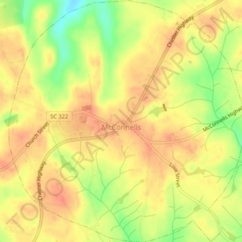
Name: McConnells topographic map, elevation, terrain.

Location: McConnells, York County, South Carolina, 29726, United States (34.85426 -81.24480 34.88460 -81.20866)

Average elevation: 200 m

Minimum elevation: 168 m

Maximum elevation: 216 m

Other topographic maps

Click on a map to view its topography, its elevation and its terrain.
Lake Wylie

United States > South Carolina > York County

Average elevation: 188 m

Catawba

United States > South Carolina > York County

Average elevation: 177 m

Blairsville

United States > South Carolina > York County

Average elevation: 176 m

Pineview

United States > South Carolina > York County > York

Average elevation: 217 m

Gear up for your next adventure:

🕶️Polarized Sunglasses - Reduces glare from snow and water at high elevations
⛺Backpacking Tent - Lightweight tent for long-distance hiking trips
🏕️Camping Hammock - Integrated protection for sleeping between trees
🛶Canoe Life Vest - Safety vest for water sports
🧢Hiking Hat - Sun-protective and breathable hats for long treks

As an Amazon Associate, this site earns from qualifying purchases at no extra cost to you.