Geolocate

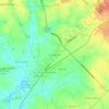
Sharon topographic map

Click on the map to display elevation.

About this map

Name: Sharon topographic map, elevation, terrain.

Location: Sharon, York County, South Carolina, United States (34.94207 -81.36059 34.96364 -81.33022)

Average elevation: 183 m

Minimum elevation: 147 m

Maximum elevation: 206 m

Other topographic maps

Click on a map to view its topography, its elevation and its terrain.

Catawba

United States > South Carolina > York County

Average elevation: 177 m

Lake Wylie

United States > South Carolina > York County

Average elevation: 188 m

Blairsville

United States > South Carolina > York County

Average elevation: 176 m

Pineview

United States > South Carolina > York County > York

Average elevation: 217 m

Gear up for your next adventure:

💡Solar Camping Lamp - Eco-friendly lighting for campsites
🥾Hiking Shoes - Durable and comfortable shoes for trail hiking
🧥Waterproof Hiking Jacket - Protect yourself from rain and wind while hiking
🎒Hiking Daypack - Lightweight and durable backpacks for day trips and excursions
⛺Backpacking Tent - Lightweight tent for long-distance hiking trips

As an Amazon Associate, this site earns from qualifying purchases at no extra cost to you.