Geolocate

Mottola topographic map

Click on the map to display elevation.

About this map

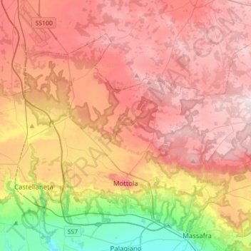
Name: Mottola topographic map, elevation, terrain.

Location: Mottola, Taranto, Apulia, 74017, Italy (40.60374 16.92373 40.76076 17.20330)

Average elevation: 299 m

Minimum elevation: 22 m

Maximum elevation: 500 m

Other topographic maps

Click on a map to view its topography, its elevation and its terrain.

Marinara

Italy > Apulia > Taranto > Mottola

Average elevation: 261 m

Saturo

Italy > Apulia > Taranto > Leporano

Average elevation: 12 m

Gear up for your next adventure:

👟Leg Gaiters - Keep debris, mud, and snow out of your boots
🥾Waterproof Hiking Boots - Essential footwear for rugged terrain and wet Canadian trails
🎒Fully Waterproof Backpack - Total protection for photography gear and electronics
🍽️Titanium Camping Spork - Ultralight and indestructible eating utensil
🥾Light Trekking Boots - Supportive boots for multi-day treks

As an Amazon Associate, this site earns from qualifying purchases at no extra cost to you.