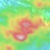
Belford Roxo topographic map
Click on the map to display elevation.
About this map

Name: Belford Roxo topographic map, elevation, terrain.
Location: Belford Roxo, Rio de Janeiro, Southeast Region, Brazil (-22.77759 -43.43408 -22.68511 -43.31979)
Average elevation: 30 m
Minimum elevation: 1 m
Maximum elevation: 377 m
Other topographic maps
Click on a map to view its topography, its elevation and its terrain.
Corcovado
Brazil > Rio de Janeiro > Região Metropolitana do Rio de Janeiro > Rio de Janeiro
Average elevation: 221 m
Sugarloaf
Brazil > Rio de Janeiro > Região Metropolitana do Rio de Janeiro > Rio de Janeiro
Average elevation: 17 m
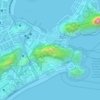
Morro da Babilônia
Brazil > Rio de Janeiro > Região Metropolitana do Rio de Janeiro > Rio de Janeiro
Average elevation: 29 m


Quinta da Boa Vista
Brazil > Rio de Janeiro > Região Metropolitana do Rio de Janeiro > Rio de Janeiro
Average elevation: 19 m
Vale das Pedrinhas
Brazil > Rio de Janeiro > Região Metropolitana do Rio de Janeiro > Guapimirim
Average elevation: 8 m
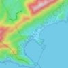
Morro da Babilônia
Brazil > Rio de Janeiro > Região Metropolitana do Rio de Janeiro > Rio de Janeiro
Average elevation: 29 m
Praça Heitor Bastos Tigre
Brazil > Rio de Janeiro > Região Metropolitana do Rio de Janeiro > Rio de Janeiro
Average elevation: 7 m

Manuel de Morais
Brazil > Rio de Janeiro > Trajano de Moraes > Visconde de Imbé
Average elevation: 362 m
Morro da Babilônia
Brazil > Rio de Janeiro > Região Metropolitana do Rio de Janeiro > Rio de Janeiro
Average elevation: 29 m