Geolocate

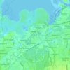
Tabon III topographic map

Click on the map to display elevation.

About this map

Name: Tabon III topographic map, elevation, terrain.

Location: Tabon III, Kawit, Cavite, Calabarzon, 4104, Philippines (14.42575 120.90012 14.43888 120.90550)

Average elevation: 6 m

Minimum elevation: 0 m

Maximum elevation: 11 m

Other topographic maps

Click on a map to view its topography, its elevation and its terrain.
Binakayan

Philippines > Cavite > Kawit

Average elevation: 4 m

Island Cove

Philippines > Cavite > Kawit > Binakayan

Average elevation: 1 m

Tabon

Philippines > Cavite > Kawit > Tabon

Average elevation: 5 m

Panamitan River

Philippines > Cavite > Kawit

Average elevation: 3 m

Gear up for your next adventure:

🥽Outdoor Goggles - Protective eyewear for outdoor activities
🔪Outdoor Multitool - Versatile tool for repairs and food prep in the wild
⛺Tent Footprint - Protect tent floor and increase durability
💧Hydration Pack - Hands-free hydration system for long hikes
🧢Outdoor Cap - Protective cap for sun and rain during hikes

As an Amazon Associate, this site earns from qualifying purchases at no extra cost to you.