Geolocate

Binakayan topographic map

Click on the map to display elevation.

About this map

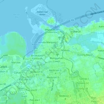
Name: Binakayan topographic map, elevation, terrain.

Location: Binakayan, Kawit, Cavite, Calabarzon, 4104, Philippines (14.42985 120.90312 14.46985 120.94312)

Average elevation: 4 m

Minimum elevation: -3 m

Maximum elevation: 12 m

Other topographic maps

Click on a map to view its topography, its elevation and its terrain.

Island Cove

Philippines > Cavite > Kawit > Binakayan

Average elevation: 1 m

Panamitan River

Philippines > Cavite > Kawit

Average elevation: 3 m

Gear up for your next adventure:

🥾Trekking Boots - Durable boots for long-distance trekking
🧥Ultralight Puffy Jacket - Maximum warmth that packs down to the size of an orange
💡Compact LED Flashlight - Powerful and portable flashlight for outdoor use
🚲Heavy Duty Bike Lock - Secure your bike at the trailhead or during stops
🗺️Topographic Maps - Detailed maps to explore trails, mountains, and wilderness areas

As an Amazon Associate, this site earns from qualifying purchases at no extra cost to you.