Geolocate

Caroline Springs topographic map

Click on the map to display elevation.

About this map

Name: Caroline Springs topographic map, elevation, terrain.

Location: Caroline Springs, Independence Creek Road, Terrell County, Texas, United States (30.46898 -101.80356 30.46908 -101.80346)

Average elevation: 653 m

Minimum elevation: 600 m

Maximum elevation: 765 m

Other topographic maps

Click on a map to view its topography, its elevation and its terrain.
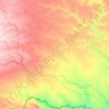
Terrell County

United States > Texas > Terrell County

Average elevation: 739 m

Gear up for your next adventure:

☕Camping Coffee Maker - Brew fresh coffee anywhere on the topographic map
🧢Sun Protection Cap - Breathable cap to protect from sun exposure
🧼Biodegradable Camp Soap - Environmentally friendly cleaning for gear and body
🥾Mountaineering Boots - Supportive boots for climbing and high-altitude hiking
⛺Family Camping Tent - Spacious tent suitable for family camping trips

As an Amazon Associate, this site earns from qualifying purchases at no extra cost to you.